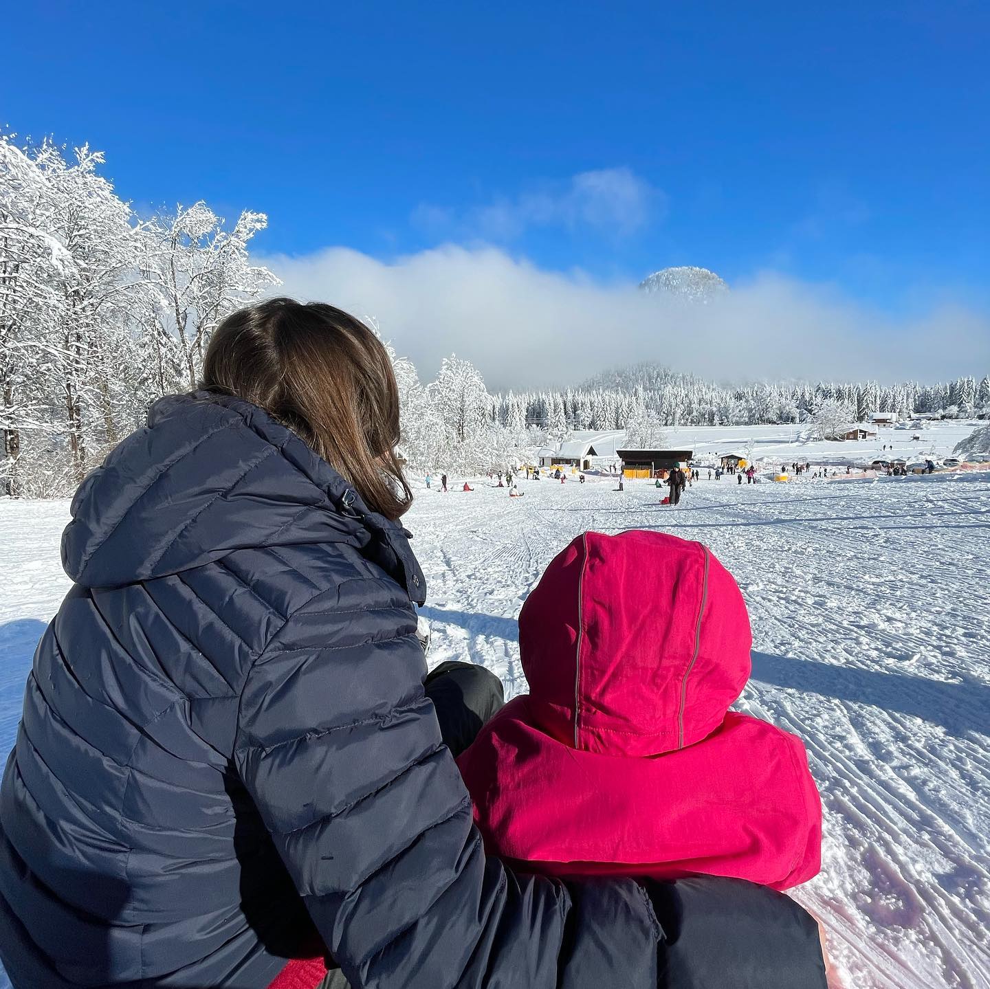
Situated on Valbruna’s soft slope Kugy 1, the Kinderalm consists of two conveyor lifts that allow you to slide safely. Thanks to its gentle slope, the Valbruna Snow Park is ideal for sledding/bob lovers.
This year you can use the lifts, car parks and toboggans/bobs for free!
CLOSED
Skiing is NOT allowed.
For information: Tourist Office of Malborghetto-Valbruna +39 0428 64970 (extension no. 2) info@visitvalcanale.it www.visitvalcanale.it
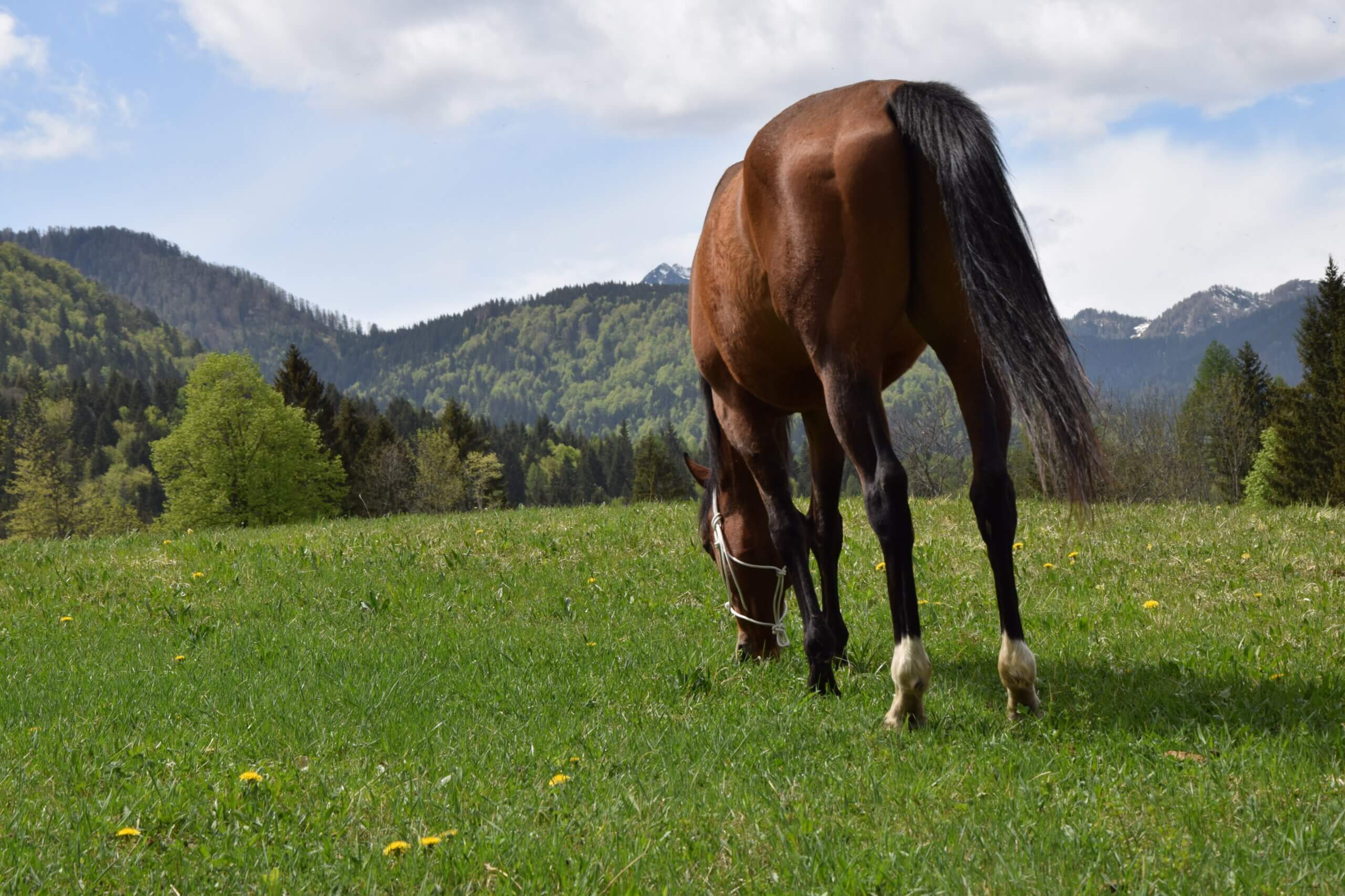
The art of connecting with horses through presence only. A relational approach and a path full of emotions that allows us to establish a deep contact with the animals and with ourselves.
Michela Battistutti +39 327 2253225 mb.freesoul@libero.it www.freesoulhorse.it Santa Caterina Via Rio Bianco, 4 Malborghetto-Valbruna
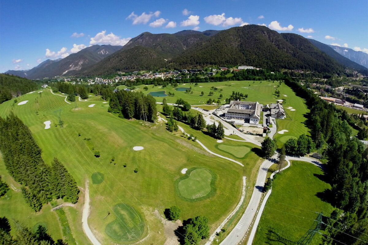
The Tarvisio Golf Club offers a mountain course with extensive natural fairways on the plateau. The course has two distinct paths. The first has 9 holes, like the second, that also includes some water features and stretches over a mostly flat territory, with large greens sometimes hidden among the pine and beech trees, often protected by bunkers or hollows. It is nestled in the beautiful landscape of the imposing rocky peaks of the Julian Alps, with a view of the rocky mountain Mangart (2,677 metres). The Tarvisio Golf Club is a course full of interesting technical aspects, surrounded by a fascinating setting that transforms each game into an unforgettable experience..
Technical data Holes: 18 holes – par 71 Course Length 5,387 metres Men: CR 69,2 – SR 119 Women: CR 69,8 – SR 120 Additional services: driving range, Putting Green, Pitching green, clubhouse, changing rooms, pro-shop, cart and trolley rental, bar..
The Grass Mini Golf of Valbruna was created in 1991 and it has 18 holes par 72. Played with classic golf rules and regular balls golf and putters, it can be played by adults and children.
Tennis enthusiasts have the possibility of playing among inspiring green scenery. The Tarvisio Tennis club and the sports field of Malborghetto offer well-tended tennis courts with refreshments available.
Five-a-side football and volleyball
The Ugovizza multifunctional centre and the sports field of Malborghetto have a five-a-side football field and volleyball courts for your recreational activities. The Tarvisio sports field is more complex and offers a soccer field, training field and athletics field.
The Pump Track itinerary has straight and curved sections with humps, speed bumps and parabolic curves suited to all types of sports combination ready for users’ recreation and fun. The aim of this activity is to finalize the track getting to the end without pedaling, using only the “pump” push of the body created by the constant movement of extension and bend. This facility is suitable both for children that are becoming familiar with bikes or adults who want to improve their riding techniques. On the track are allowed: balance bikes, scooters, skateboards, roller skates or mountain bikes.
Info: +39 327 4329604 +39 346 4199423
For rental, maintenance and accompaniment: Luca +39 340 4166081 Giulio +39 340 4816796
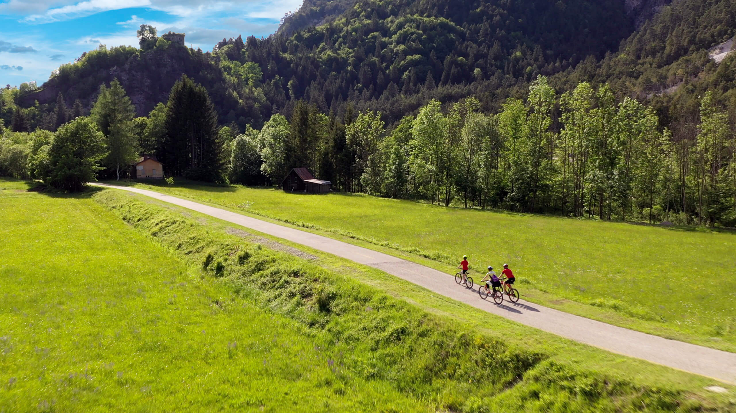
ALPE ADRIA CYCLE-PATH
An exemplary case of an old railway line conversion, the Alpe Adria Cycle-path unites Italy, Austria and Slovenia in a single route, along the Valcanale and the Canal del Ferro valleys located at the extreme North-Eastern strip of Italy. The route is suitable for cyclists of every level. It winds for over 61 km, crosses 592 metres of iron bridges and 3,739 metres of tunnels and offers wonderful landscape views, so much so that it is considered among the most beautiful cycling routes in Europe! Delightful villages, natural monuments, interesting tourist attractions and magnificent landscapes will accompany you from the Alps to the sea, riding your faithful travel companion, the bicycle!
Two kilometres, with a slight slope, suitable for pushchairs, wheelchairs for the disabled, mountain bikes and bicycles. A barrier-free path allows everyone, no one excluded, to immerse themselves in nature, enjoy the alpine landscape beauty, breathe the bracing air and the cosy atmosphere of the woods. A valley floor route connects the Alpe Adria Cycle Route with the centre of Valbruna: the queen of the Julian Alps!
STARTING POINT: at Fort Beisner “Opera 4” along the municipal road between Ugovizza and Valbruna ARRIVAL: Valbruna – town LENGTH: 2 km.
ROAD CYCLING
The extraordinary mix of ambitious climbs to the alpine passes through the Tre Confini territory (Three Borders). Long flat stretches along the valley floor make Valcanale an undisputed paradise for road cycling enthusiasts. Dreaming of wearing the pink jersey (symbol of the Italian bike tour), you can try the epic mountain stages such as the Piani del Montasio, the Pramollo Pass, the Ugovizza valleys, the Vrsic (SLO) and the Wurzenpass (AT), the Alpenstrasse del Dobratsch (AT), the Cason Pass of Lanza and the Pass del Predil.
MOUNTAIN BIKE
Mountain biking is a way to discover places far from traffic and to combine the love for nature with the pleasure of doing sports. The Valcanale is full of routes suitable for this discipline and offers a visit to appealing environments such as the Ugovizza valley, the Bartolo and Camporosso Valley, the Rio Freddo Valley and the Fusine lakes. There is never any boredom for mountain bikers and free-riders, who will be able to enjoy forest roads, retrace the old military routes and enjoy easy paths through woods and meadows.
Some classic routes are:
Ring route of Val Saisera, Val Bartolo, Alpe di Ugovizza, Val Rauna, Malga Meseznig, Nordio shelter, Mount Acomizza, Mount Goriane, Mount Forno, Mount Lussari, Zacchi Shelter, Rio Freddo valley, Cappella Zita, Malga Strachizza, Malga Ciurciule, Sella Collarice, Grego shelter, Valbruna plain and Opera4.
If you find great adventures fascinating, you must know that Valbruna and Tarvisio are part of the Alpe Adria Trail circuit, a cross-border project that connects the three regions, Carinthia, Slovenia and Friuli-Venezia Giulia. A long-distance itinerary that leads from the foot of Austria’s highest mountain, the Großglockner, to the shores of the Adriatic Sea, in Muggia. The route spreads over 43 stages of about 20 km each, with a walking time of about 6 hours through the most beautiful stretches of mountain and lake landscapes of Carinthia. It then crosses the Tarvisio directly near the Austrian, Slovenian and Italian borders and then continues to the sea.
A spiritual journey from the coast to the mountains of Friuli Venezia Giulia
The Aquileia route – Cammino Celeste is an international religious route that winds between Italy, Austria and Slovenia with the aim of bringing together the pilgrims of the different nations to a particular place of worship that is the Sanctuary of mount Lussari: a destination for pilgrimage and veneration of the image of the Virgin Mary for centuries. The pilgrims walk from their starting locations, along the three routes to Camporosso, to begin the climb that takes them to Mount Lussari, over 1760 metres above sea level. The Italian part of the Cammino Celeste winds through ten stages. The starting point is in Aquileia. It then crosses Cormòns, Castelmonte, Cividale del Friuli, the Gran Monte and the valleys of Resia and Dogna up to the Sanctuary of Mount Lussari.
Romea Strata follows the ancient system of routes that led from the North-East of Italy to Rome. The entire section covers five regions and is 1300 km long. The section that passes through Valcanale is called Romea Alemagna and from Tarvisio reaches Concordia Sagittaria (PN) after 187 km. It is a journey that touches different places and cultures, a dive into the past and a unique way to explore the territory of Friuli Venezia Giulia.
Guaranteed fun among inflatables and the crazy itinerary of the bobsleigh on rails
In Tarvisio, fun for young and old is guaranteed. The play area on Piana dell ‘Angelo offers large and small inflatable games, grass bikes, summer tubing (summer inflatables), bobsleighs on grass, bobsleighs on rails and the new zipline!
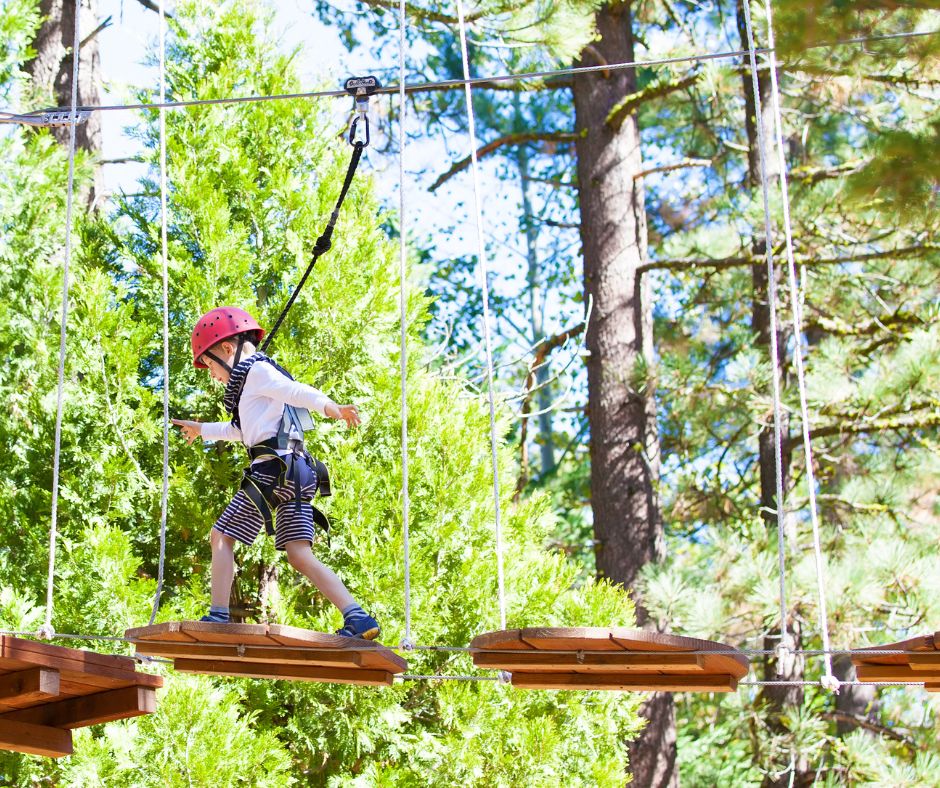
You go in as a curious beginner and come out an enthusiastic expert
“Adventure Park” means having fun being surrounded by nature, venturing on paths suspended among the trees and putting yourself to the test. With full respect for the environment and in total safety, you can fly between trees by sliding on a pulley, balance on Tibetan logs or bridges, climb, and much more on the five paths of increasing difficulty.
The villages of Valcanale offer places to let off steam and leisure areas for children of all ages. Areas with swings, slides and much more. With small restaurants nearby for refreshments. Always and in any case immersed in the greenery that characterizes the valley and its activities.
Devotional path among the Vie Crucis (stations of the cross) of Malborghetto – Valbruna and St. Stefan im Gaital
The Vie dello Spirito is a religious route that takes up the ancient practice of pilgrimage and, in particular, of the Via Crucis. This cross-border route that connects Malborghetto to St. Stefan promotes the historical and artistic wealth of the two towns through a joint pilgrimage and hiking itinerary.
Reaching the final destination, the wonderful Calvari, you can admire the beautiful chapels – stations, an expression of the local manufacturing ability of the time.
Technical data of the route
Chiesa del Calvario – Malborghetto: 0.3 km / 20 minutes Malborghetto – Ugovizza: 2.5 km / 40 minutes
Ugovizza – F.lli Nordio Shelter: 11 km / 5 hours– Dolinzaalm – Vorderberg: 9 km / 3 hours
Vordereberg – St. Stefan: 4.5 km / 1 hour – St. Stefan – Chiesa del Calvario: 0.3 km / 15 minutes
The peaks with fascinating names: l’Innominata, la Madre dei Camosci, Cengia degli Dei, the Montasio. These are the peaks loved by Kugy and entire groups of mountaineers, who guard the Great War’s terrible secrets in the Julian Alps.
The restored ruins of walkways, trenches and stations have become the “Abschnitt Saisera” Theme Park, named after the military section that operated on site. A three-ring route starts from the valley floor between first-line trenches. It then reaches machine gun and cave cannon positions and then, under the west wall of the Piccolo Nabois, the “Geschütz Kaverne”, the mountain cannon positions.
Not far from “Abschnitt Saisera”, along the municipal road to the Saisera Valley, is the Austro-Hungarian Cemetery of Valbruna – the cemetery of the heroes of the 608th. 179 soldiers rest here in peace. The holy ground gave a decent burial not only to the fallen of the Austro-Hungarian Empire but also to the soldiers of the enemy army, victims more than to fighting, of the killer ice and the winters in trenches along the vertical walls of the mountains that were the border between the two countries.
Parking: P3 of Val Saisera near the Locanda Jôf di Montasio. Level of difficulty: for tourists (green ring), for excursionists (blue and red ring) on marked paths Elevation difference: 292 metres (total) Length: 5,9 kilometres (total) Excursion length: from 1 to 3 hours depending on the chosen visiting area Equipment: mountain clothing and shoes, a change of clothes, a good supply of food and water and a torch to visit the tunnels. It is advisable to be in good physical shape for the blue and red rings Advised visiting period: from April to October
A mini-trekking and art park in the heart of Malborghetto where you can admire all the mammals present in Valcanale on wooden silhouettes, expertly painted by the local artist Marina Gioitti, perfectly in line with reality, for size, colours, appearance and characteristics. Deer, roe deer, bears, marmots, chamois, and many other animals are the protagonists of a small fairy tale that is also a perfect ecological handbook and a reflection on nature and landscape principles. With your children, you will be able to read the fairy tale of Animalborghetto in a magical little house at the entrance of the path in the picnic area. At the end of the mini-trekking for children, in the Ethnographic Museum, a few metres from the start of the path, you can buy the book with the Animalborghetto fairy tale
Starting point: the centre of Malborghetto, in Via Bamberga at the Krahvogl house, near the stone porch.
Car park: in the area of the parish church and Ethnographic Museum Palazzo Veneziano
Average visiting time: you will need at least an hour (when it is about fun and reading, it is difficult to give exact indications…)
Means of transport: the path can only be walked but no worries! Where the pushchair can’t reach, there are plenty of other possibilities… backpacks, wraps, baby carriers. The important thing is not to miss this mini trekking in the mountains even with small children: future passions are sometimes born from the parents’ good habits!
Last tip: along the way, try not to imitate the misdeeds of Brutus, Ascella and Grugno and instead follow Emil’s example! If you want to know more… Well… All you have to do is come to ANIMALBORGHETTO!
The Forest Sound Track,the so-called Resonance Tree Trail, leads from Valbruna into an extraordinary spruce forest ideal for the production of musical instruments. Just think that violins, harpsichords and other musical instruments produced with the precious Valcanale wood are exported worldwide!
The Forest Sound Trackis an exciting 5.5km (and as many to return) route, fully signposted, which will take you to the Resonance Fir site, where you’ll find many information boards describing these magnificent trees and the art of lutes. Along the way, besides wooden sculptures, recalling the world of music, you will find different points of interest that will attract your attention, making this trek truly unique.
The Forest Sound Trackcrosses the Abschnitt Saisera, a theme park of the Great War, in the heart of Val Saisera.
Technical data of the route
Distance from the arrival of the Resonance Tree site:
From Valbruna 5.5 km/ 2 hours and 30 minutes
From Saisera Hütte 4 km/ 1 hour and 45 minutes,
From Agritourism Prati Oitzinger 2.7 km/ 1 hour and 20 minutes,
A silent witness to The First World War, Fort Hensel in Malborghetto is a symbol par excellence of the Great War in Valcanale. Heavily bombed starting from June 1915, even today, the Habsburg fort with its ruins tells of the brutality of the war, the impossible conditions in which the soldiers found themselves fighting and the circumstances that marked the passage of Valcanale to Italy.
SOLDIERS’ TRAIL – SOLDATENWEG
An exciting route that connects the centre of Malborghetto with Fort Hensel passing through the panoramic point of the Testa di Malborghetto/Buchkopf at 1,260 metres above sea level. A site of historic interest where the ruins of the right side of the Fort Hensel observatory are located. The ruins of the war artefacts and the lovely panoramic views, which allow you to admire the Julian Alps’ peaks from which the Italian army bombed the valley, make it a fascinating destination. The path, wanted and conceived by the Municipality of Malborghetto-Valbruna, is configured as an extraordinary trek in nature, undoubtedly unforgettable for the unique opportunity to walk in the footsteps travelled over 100 years ago by soldiers, men and boys who, with all the climatic difficulties, climbed and perched on these mountains to defend the ideals of their Empire with blind enthusiasm.
Clothing: Mountain shoes, backpack with wind jacket, water
Phone signal: yes
Height: P.zza Palazzo Veneziano Malborghetto 715 metres above sea level Testa di Malborghetto-Buchkopf 1260 metres above sea level Summit Fort Hensel 820 metres above sea level P3 – Car park Fort Hensel 758 metres above sea level
Recommended visiting period: from May to October
PEACE TRAIL – FRIEDENSWEG
Fort Hensel crossing path that winds through the fort’s ruins and traces the route that the Austro-Hungarian military used in peacetime to move within the military complex. Being exposed to the cannon fire of the Italian army stationed in Val Dogna, this path was not used in wartime.
The route is configured as a short walk among the fortress ruins built in the second half of the 1800s and made functional in 1884. Walking along the road to the right of the entrance of the “Fort tunnel” (P3), or starting from the parking lot (P2), you climb following the signs for the access roads to the fort until you reach the courtyard of Block B. From there, continue on the Path of Peace to the top of Block A, a panoramic point on the valley and site of the mortar bases. Admire the bastion on which the flags are hoisted, go down the same route to the starting point.
Starting point: P2/ P3
Excursion length: 1 hour
Height: P3 Car park 758 metres above sea level Fort Summit 820 metres above sea level
Recommended visiting period: from April to October
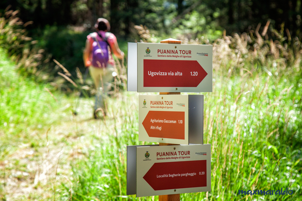
A journey through the Ugovizza malghe to discover the genuine flavours of tradition
A perfectly marked tour among the malghe (Shepherd huts) of Ugovizza. A tour that connects the town of Ugovizza with the agritourisms and mountain shelters of Val Rauna, Val Filza and Val Uque. All the accommodation facilities and excellent refreshment points of these beautiful valleys can be can reached on foot and in sequence: you will be spoiled for choice for your lunch break! There is something to satisfy every taste among all the dishes based on homegrown ingredients, such as organic meats, local cheeses, aromatic herbs and homemade desserts. The Malghe tour is rich in splendid views and geological, historical and naturalistic features. You will visit places where time seems to have stopped, where agriculture and breeding are still practised as they were in the past and where the signs show the place names in the local languages
Length of route (standard path, with starting point in Ugovizza)
Km 16,500 – Can be walked in about 7 hours
Variant 1: direct route Ugovizza- Gortani Shelter, without passing through Malga Prju 1.40 km 3,30
Variant 2: Malga Prju- Gortani Shelter (Via alta sella Collarice-Val Rauna) 1.40 km 3,70
Length of the route, starting from Ugovizza including the variant Malga Prju-Sella Collarice-Val Rauna km 18,5 – total walking time about 8 hours
Total elevation difference starting from Ugovizza 1000 metres
Level of Difficulty:
Complete route: medium difficulty, suitable for trained excursionists
Routes with stages: easy, suitable to everyone
** To reach the Agritourisms da Michael and Gacceman in case of floods of the Uque River, near the ford of the Locanda al Camoscio, do not cross the river but continue following the signs along the path in the direction of the Rosič agritourism, near a bridge.
Advised clothing: mountain shoes, backpack with refreshments, water and a change of shoes, wind jacket.
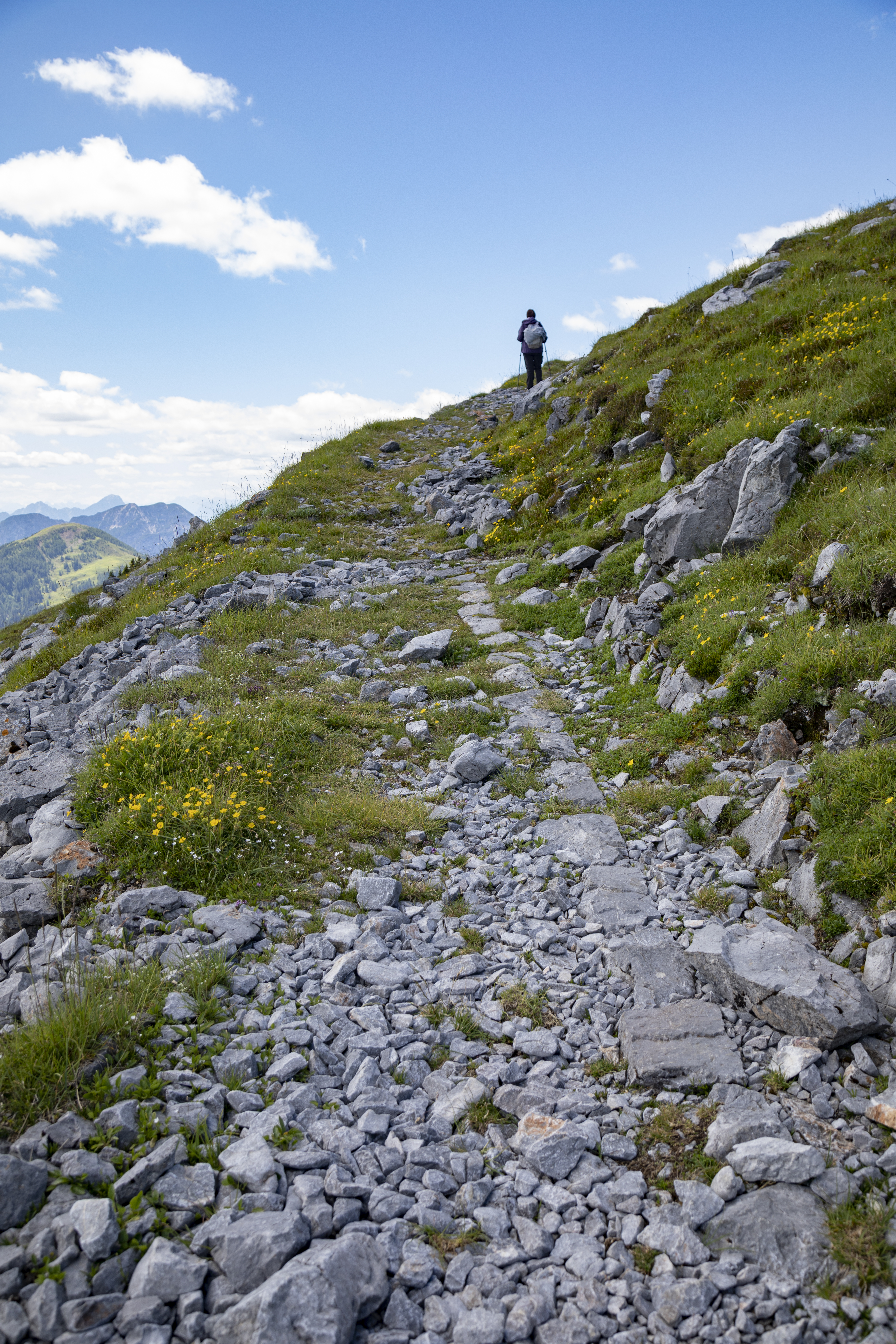
The Julian Alps offer many climbing routes. Despite the modest altitudes, these mountains are stark and wild, and in this, perhaps, lies their greatest attraction. On these mountains challenging free climbing itineraries have been mapped, counted among the most difficult in the Alps. There are also numerous aided routes and via ferrate (equipped routes). The expert hiker can experience the attraction of impressive environments usually reserved for the most reckless climber. Numerous and just as fascinating are the normal routes, without technical difficulties.
Some of the most interesting routes:
Jôf di Sompdogna, Cima di Terra Rossa, Jôf di Montasio, Jôf Fuart, Grande Nabois, Jôf di Miezegnot, Mount Re, Mount Mangart, Cima Cacciatore, Mount Canin
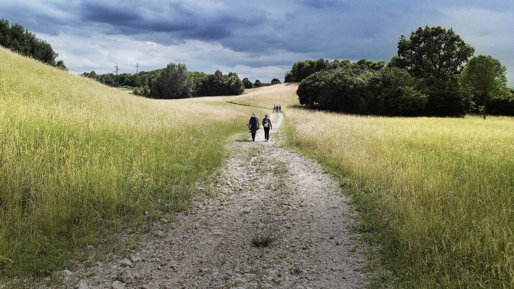
TREKKING OF MALBORGHETTO
Welcome to the Malborghetto woods!
The Trekking of Malborghetto is a circular route that, starting from the centre of the village, leads into the local and wild nature. Admire Malborghetto and Cucco in an unusual and new vision: walking along rivers, through clearings, fir and beech woods and fording mountain streams. The Trekking of Malborghetto is a modular route, where walkers can choose from three different ring trails of varying lengths.
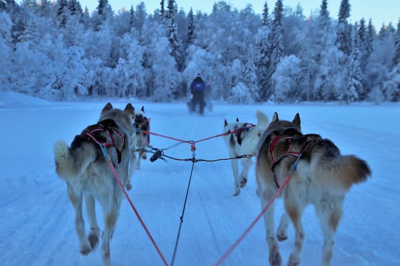
An adventure with legendary sledge dogs in a scenery like that of the Great North
Sledge dogging in Tarvisio, just a short distance from the Slovenia border, takes the name of Ararad Khatchikian, an Italian musher who has taken part in the most exciting races in the world like the Iditarod and the Yukon Quest in Alaska (USA).
Ararad is waiting for you with his 50 joyful sledge dogs in the splendid setting of the Fusine Plain
His passion will allow you to experience a once in a lifetime adventure. To become a “musher” for a day.
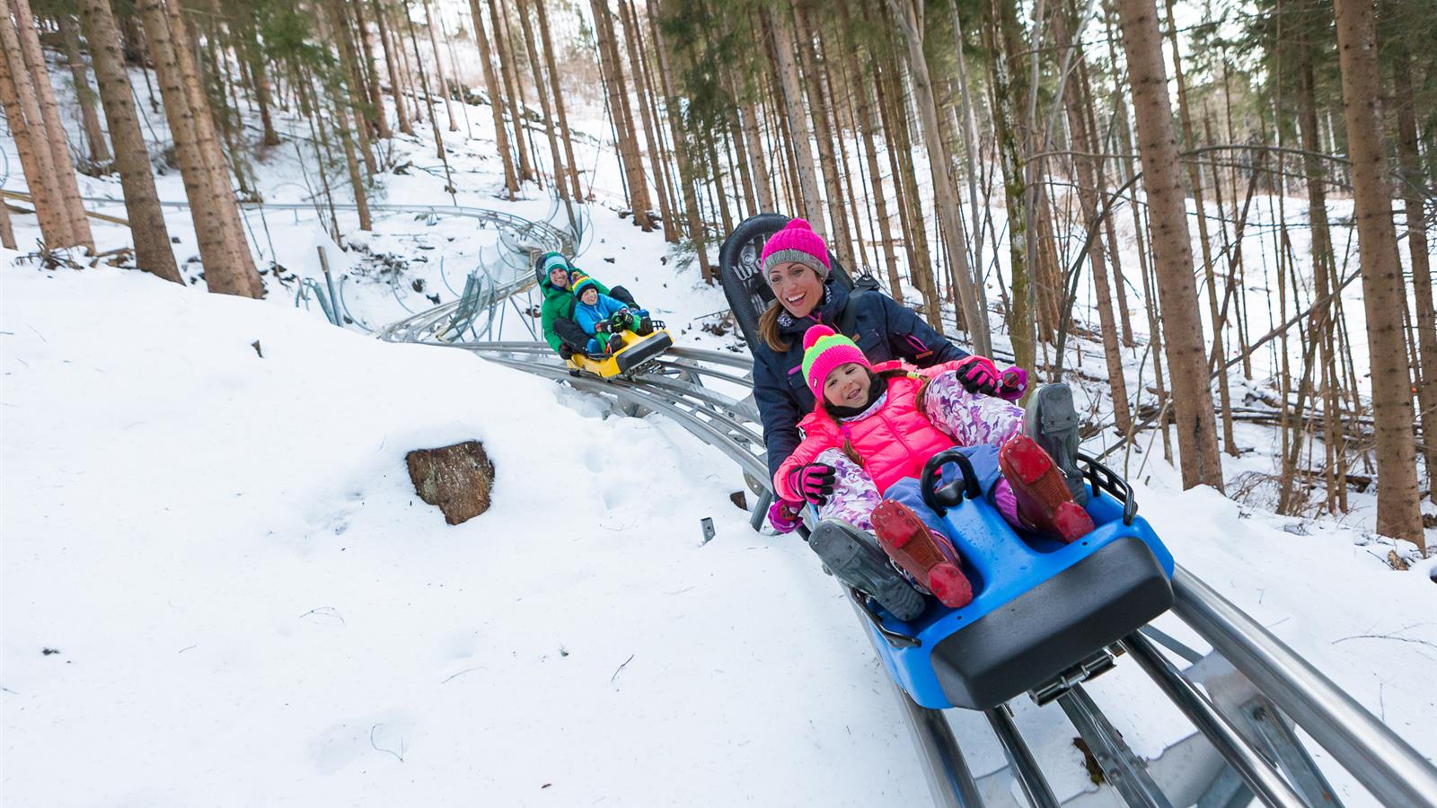
TARVISLANDIA, SNOW & FUN PARK Guaranteed fun among the inflatables and the crazy bobsleigh track
In Tarvisio we pamper our little guests both in summer and winter in areas specially designed for them. The Fun Park dell’Angelo, between Tarvisio and Camporosso, which runs along the state road, is just what you need to guarantee hours of fun and laughter, in fact it includes trampolines, a course for mini-bikes, the summer dinghy ride, the bobsleigh on rails and the Magical Fir, an inhabitant of the thousand-year-old forest of Tarvisio, which for a few hours will be the ambassador of the surrounding nature entertaining your children with slides, climbing walls and adventurous ladders. In the large meadow, the cable car with ramp will be the cable on which to hang their dreams of fun, or on the swing with basket, a hilarious game to share with friends.
In winter, the magic of the snow renews the fun park with fun games suitable for all ages: from the tobogganing areas that are easily accessible thanks to the two moving carpets, to the inflatable carousel and the Magical Fir tree.
The bobsleigh track, open in summer and winter, will give the whole family breathtaking evolutions that will thrill young and old alike!
Don’t miss the nearby animal trail accessible by the Angel chairlift, accessible both in summer and winter, where the little explorers’ skills will be put to the test as they seek out the cute inhabitants of the forest.
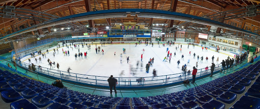
Pirouette with the big names in figure skating and Hockey
During your holiday in Valcanale you cannot miss a stop at the Pontebba ice rink, where artists like Carolina Kostner performed in front of an ecstatic audience. Here you can rent equipment and access it in total safety. Events such as Stars on Ice and Midnight, curated by Ghiaccio Spettacolo, animate the structure during the winter and summer season.
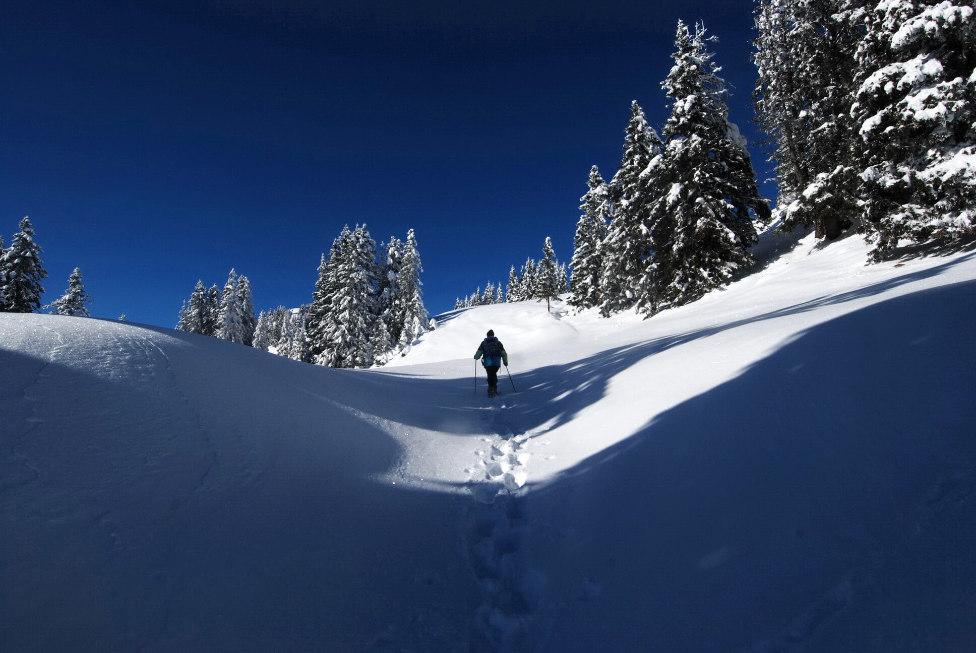
There are many ways to discover the mountain’s charm in Winter, one of these is to walk in the snow.
Off the beaten tracks, snowshoes turn out to be inseparable companions of adventures. Valcanale is the perfect place to venture with snowshoes completely alone, or if you prefer, you can take part in the next weekly guided tour
VALBRUNA BEISNER TRACK
Escaping from stress
*Guided tour of fort Beisner: Ass. Landscapes tel +39 334 1249193 / info@ls-valcanale.eu
Length: 3.5km Can be walked in about 1 hour Difficulty: easy
CLOSED
SAISERA WILD TRACK
A cure-all for the soul
A winter walk in the epic places of mountaineering and the front of the First World War. Along the route, you will find yourself in silent woods, under the harsh peaks of the Julian Alps and at the same time close to the huts and farmhouses of the valley, where you can stop for a break and taste local gastronomic specialities. In the final part of the route, you will reach the foot of the north face of the Jôf di Montasio, Julius Kugy’s favourite mountain, where the route winds in a ring through a fascinating landscape.
Length: 11 km Can be walked in about 3 hours Difficulty: easy
CLOSED
PUANINA WINTER
Ski mountaineering and snowshoeing on the Ugovizza Alps
Snowshoeing route along the Puanina Tour
Difficulty: easy
Tempo di percorrenza di sola andata
Distanza di sola andata
Rifugio Gortani – Agriturismo “Da Rosic” e Locanda “Al Camoscio”
1.30 h
Km 2.20
P3 Val Uque – Agriturismo “Da Michael”
1.10 h
Km 1.40
Agriturismo “Da Michael” – Agriturismo Gacceman
1.40 h
Km 2.40
P6 – Rifugio F.lli Nordio-Deffar * dal Rifugio una bella passeggiata di 20 minuti porta a Sella di Lom (A)
1.45 h
Km 2.00
Follow the Puanina Tour signposts along this route.
Ring route “Agritourism Gacceman”
Difficulty: medium Can be walked in about: 4 hours Starting point: P1 – former Sawmill
From the parking lot P1 – former Sawmill, hikers take the forest road to the Zafratta resort opposite the cappelletta (small chapel), which rises with some steep hairpin bends for about 1 km. Follow the signs of the Puanina Tour towards the Gacceman Agritourism until reaching it. The return route can be done in two ways: continuing on foot along the Val Filza Bassa road to the main road and, therefore, the P1, or retracing the beautiful outbound route.
Loop route “Agritourism Mezesnig”
Difficulty: medium Can be walked in about: 03:30 hours Starting point: P2 – Val Rauna
From the parking lot P2 – Val Rauna hikers should take a left following the signs for Malga Priu. At the barn of the agritourism of the same name, they should turn right onto the meadows and enter the woods. Following the Puanina Tour signs to Sella Collarice and Val Rauna – Via alta – then take a small road that, after about 1 km, reaches Mezesnig, a beautiful and extensive panoramic promontory. Descending then for about 500 metres on the climbing route, follow the signs for Sella Collarice. Once reached, descend again along the Val Rauna until you reach the Gortani Shelter and then the parking lot you started from.
Ring route “former Villaggio Cocco”
Difficulty: medium Can be walked in about: 4 hours Starting point: P2 – Val Rauna
From the parking lot P2 – Val Rauna hikers follow the signs to the Gortani Shelter.
At about 100 metres from the shelter, turn left along the forest road at first paved and then dirt until reaching the former Village Cocco, keeping to the right at a crossroad at 1448 meters of height. Then, continue along the road until you reach the extensive pastures of pad tamer, then take the road that descends to the right towards the Agritourism da Rosič. The ring route ends with the signs for the Puanina Tour near the Gortani shelter and the car park P2 – Val Ruana.
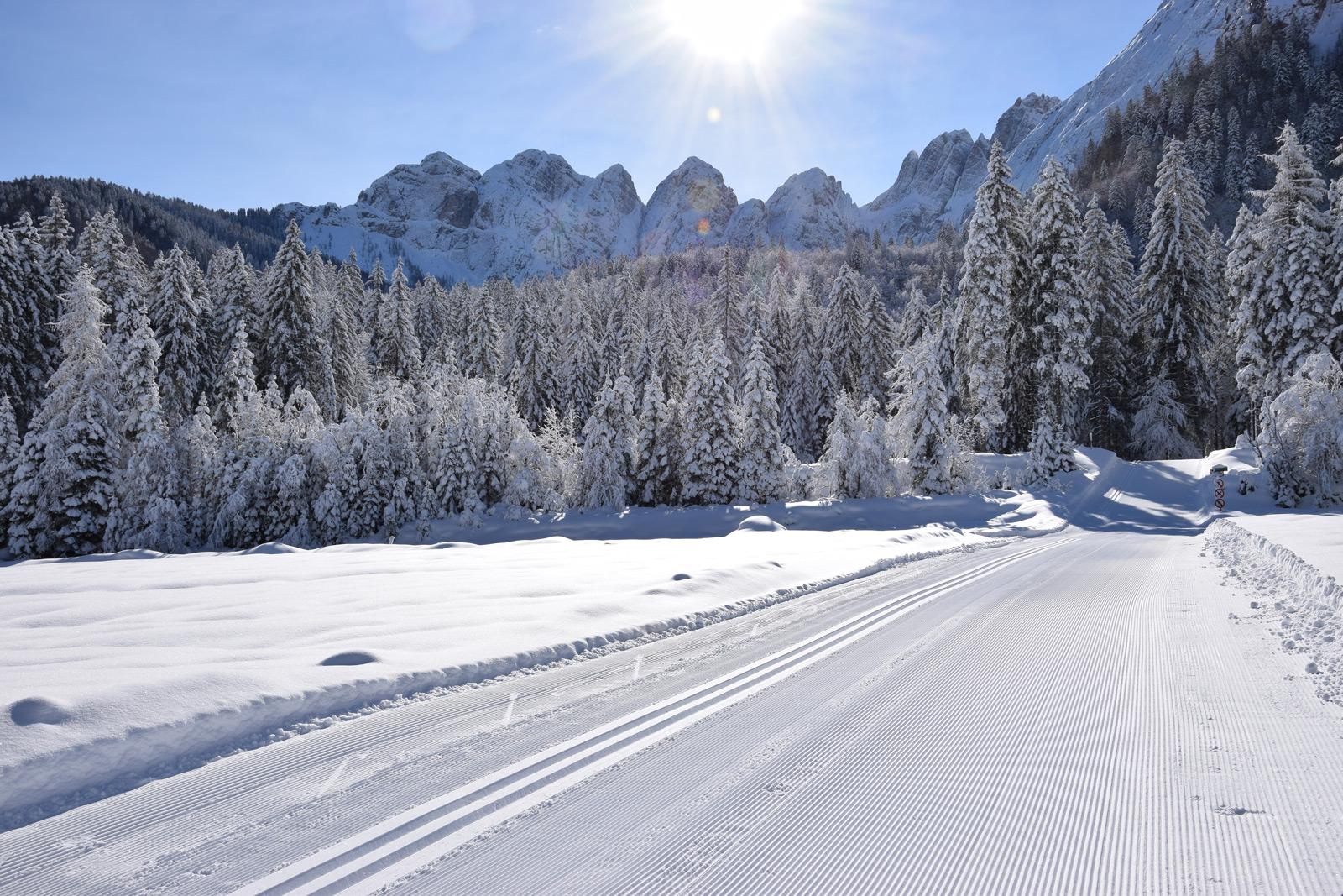
There is nothing better than cross country skiing to enjoy amazing landscapes
To unwind and recharge your batteries, put on a pair of skis and be amazed by the more than 60 kilometres of perfectly beaten tracks. Nordic skiing enthusiasts can use ski runs that cross pristine valleys at the foot of one of the mountain ranges with the most amazing views of the entire Alpine arch. Valcanale is recognized by many as the paradise of cross-country skiing, and Val Saisera is its undisputed queen: you will be struck by the peace and quiet that reigns in this corner of paradise. The ski run of the Valbruna plain and the two of Val Saisera, one of which has a snowmaking system, are the most renowned in the area. The Arena G. Paruzzi awaits you near the centre of Tarvisio. It is a ski run that develops on what is a golf course in summer.
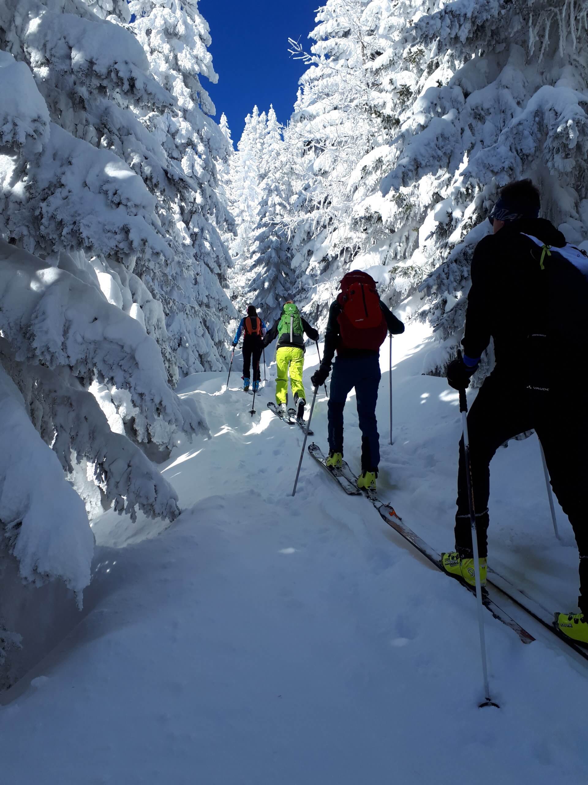
ALPINE SKIING: ENJOY THE SILENCE SURROUNDED BY NATURE
Alpine skiing is a personal and unique way of experiencing the mountains and nature in its winter guise.
More experienced skiers can try the countless routes that lead to peaks or shelters in summer and winter. Among them, the Carnic Alps, which in summer are characterized by meadows and pastures. The more demanding Julian Alps become favourite destinations for enthusiasts of this discipline in winter. The climb of Mount Cocco or Cima Bella to Mount Santo del Lussari along the classic Pilgrim’s Path, the Zacchi Shelter, the Montasio Plateau are just some of the itineraries chosen by enthusiasts of this exciting sport to surround themselves in nature in absolute tranquillity.
Main routes for alpine skiing: PUANINA WINTER with Mount Cocco, Cima Bella, Mount Oisternig, Mount Sagran and Mount Starhand; Mount Lussari, Mount Forato, Zacchi Shelter, Altopiano del Montasio. .
Itineraries of Puanina Winter
Mount Cocco 1941 metres
Elevation difference : 800 metres Difficulty: Average skier – medium slope <25° / Good skier – slope <35° direct descent from the top towards N-E Prevalent exposure: East, then North It can be climbed in about 2.30 hours Starting point P3 – P4 – P5
Climb: from car park P3, P4 or P5. Usually, alpine skiers who face Mount Cocco leave the valley floor following the forest route, which from the Locanda “Al Camoscio” rises North-West, passing some malghe (shepherd huts). They usually choose between two distinct paths at the first bridge: the first doesn’t cross the bridge. After a hairpin bend to the left, it continues straight ahead over grazing hills or sparse woodland, gaining the open slopes below the saddle between Mount Cocco and Cima Bella. The second, crossing the bridge, allows the skiers to pass on the valley’s left side (an advisable option if the right side is not very snowy) down a small path, or even through the woods with no fixed route, leading to the stone building of the Villaggio Cocco (1460 metres) reached by another small road. Along this route, on the right, the alpine skiers generally climb up to a clearing where they cross the previous route (1536 metres). Continuing on open ground, they reach the saddle between the two peaks (1814 metres) and, to the left, near the North ridge, climb to the summit.
Descent: is generally along the same climbing route. The most demanding alpine skiers can also descend from the summit directly North-East down a fairly steep slope..
Cima Bella 1911 metres
Elevation difference: 770 metres Difficulty : Average skier – medium slope < 25° Prevalent exposure: varies It can be climbed in about 2.30 hours Starting point : P3 – P4 – P5
Climb: the climbing route coincides with that of Mount Cocco up to the saddle at an altitude of 1814 metres. From here, along the right side of the ridge, it touches the extensive peak (boundary stone).
Descent: Alpine skiers generally descend along the easy and enjoyable climbing route. However, they often find it interesting to descend through the woods in the North / North-East direction, often on fresh snow. At the end, they keep to the right to gain the Forcella Fontana Fredda (1683 metres), crossed by a small road. They then make an S (without following the valley floor, however more or less skiable, but keep on the route that is initially flat on the right side), following the pleasant road that after about 1 km emerges on the glades at the crossroads of 1536 metres of altitude, where the climbing route passes.
Mount Sagran 1931 metres
Elevation difference : 800 metres Difficulty: Average skier – medium slope < 25° Prevalent exposure: South-East, then West It can be climbed in about 2.30 hours Starting point: P3 – P4 – P5
Climb: from car park P3, P4 or P5. Alpine Skiers usually follow one of the two routes described above to reach the crossroads at 1536 metres of altitude. Here they take a right on a small road, flanked by fir trees, which branches off towards North-West at a moderate slope and, once they reach the bottom of a valley, they climb along two hairpin bends towards Forcella Fontana Fredda (1683 metres). Turning right, they face the prominent Western ridge, remaining on the left side, first between high fir trees, then on increasingly open ground to the panoramic summit.
Descent: Alpine Skiers follow the climbing itinerary, always defining the descent as pleasant and worthwhile.
Mount Starhand 1968 metres
Elevation difference: 850 metres Difficult : Average skier – medium slope < 25°,< 35° Prevalent exposure: varies It can be climbed : in about 2.30 / 3 hours Starting point : P6 – former Nordio Shelter.
Climb: From car park P6 – former Nordio Shelter. Alpine Skiers usually follow the forest road that leads to the shelter of the same name for about 2 km. Leaving the shelter on the right, they briefly touch Sella di Lom (1460 metres) and the village of Dolinza Alm. From here, they turn left, passing between the malghe pastures and following a forest road that climbs diagonally on the right side of the slope above until reaching the edge of the forest. They then return to the left to go around the ridge and climb on the right side of the valley called in the local language “Papret”. On reaching the open slopes below the ridge between Sagran and Starhand, they approach the latter moving to the right of the hilltop, up to the rocks that support the summit ridge, crossing to the right in the direction of the grove they face a short steep gully that leads to the top.
Descent: Skiers usually descend along the main ridge along the south side towards Mount Sagran. Once at the foot of the latter, either they reach the summit (80 metres of altitude difference) by going down the excellently skiable west ridge, or they descend directly to the right down a steep wooded valley. They have to move gradually to the left when approaching the Forcella Fontana Fredda and not risk being too low. Crossing the mountain pass, they return to the Camoscio along the Pad Tamer valley.
Mount Ojsternig 2050 metres
Elevation difference : 900 metres Difficulty: Good skier – slope < 35° Exposure: West, then South Can be climbed in 2.30 / 3 hours Starting point : P6 – former Nordio Shelter
Climb: From the car park P6 – former Nordio Shelter. Alpine Skiers usually continue on a forest road to the shelter of the same name. They turn right and, along a short stretch on the valley floor, follow the signs on the left side (n. 403/404) of the mule track towards Sella Bistrizza. With some initial stretches through the dense forest and then with a long diagonal path on increasingly open ground, they reach the saddle (1718 metres). Before reaching it, they directly attack the south side, twisting and turning between outlying rocks, reaching the hilly summit and then the extensive peak.
Descent: The skiers descend along the climbing route.
Skiing in Valcanale means taking breathtaking routes that meet the expectations of skiers looking for panoramic and technical ski runs. It means being amazed by unique scenarios such as the Sanctuary of Mount Lussari, and above all, it means forgetting the stress of mass skiing. The skiing facility in Tarvisio and Sella Nevea, represented by 25 km of skiing areas, is especially suitable for experienced skiers and offers the opportunity to try technical and exciting ski runs. The “Di Prampero” ski run in Camporosso stands out, with its 4 km and almost 1,000 metres of difference in altitude, queen of the alpine ski runs of Friuli Venezia Giulia and the scene of Women’s World Cup Super G competitions.
Italian skiing and Snowboard school Evolution 3 Lands
Alpine, Snowboard, Cross country, Freestyle and Freeride Skiing School headquarters: Via Roma 62, Tarvisio; Campo Scuola Evoland: Piazzale Nuova Priesnig, Via degli Alpini 3, Tarvisio.
This site uses technical and third-party profiling cookies for its functionality and to improve your browsing
experience. Click accept to consent. To change your preferences or refuse all cookies, except for
functionality cookies and those strictly necessary for the use of the site, click on "Change preferences".
This site uses cookies to improve your browsing experience. From these cookies, those that are classified as necessary are stored in the browser as they are essential for the site to function. We also use third party cookies that help us analyze and understand how you use this website. These cookies will be stored in your browser only with your consent. You also have the option to opt out of these cookies (opt-out). However, the exclusion of some of these cookies could affect your browsing experience
This site uses cookies to improve your browsing experience. From these cookies, those that are classified as necessary are stored in the browser as they are essential for the site to function. We also use third party cookies that help us analyze and understand how you use this website. These cookies will be stored in your browser only with your consent. You also have the option to opt out of these cookies (opt-out). However, the exclusion of some of these cookies could affect your browsing experience